|

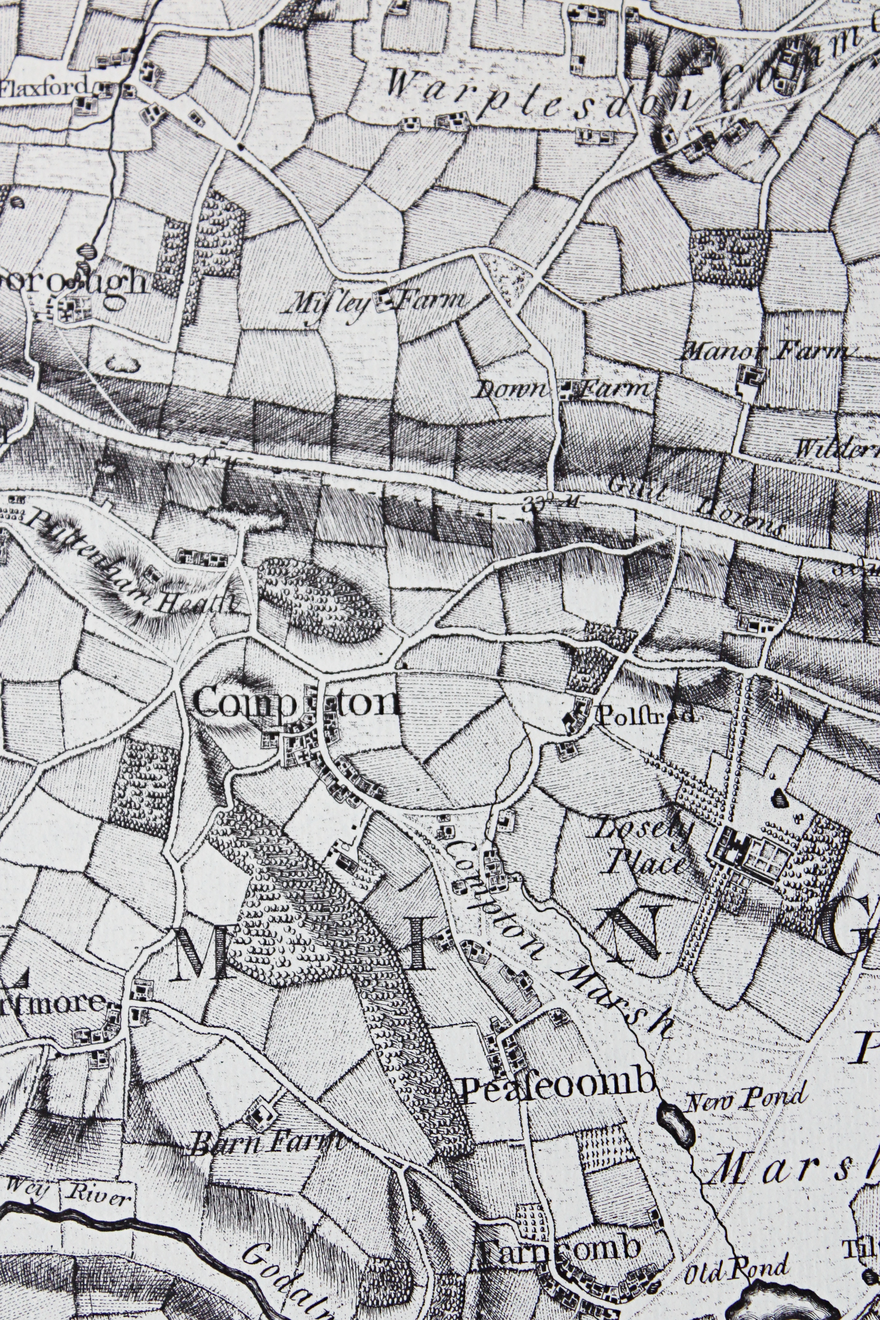
John Rocque's map of Surrey, c.1760.
John Rocque made his map of Surrey during the late 1750s and was published posthumously by his widow. This extract shows Compton and its immediate surroundings. Given the era in which it was made, his map is surprisingly accurate.
If he showed a building then it was there, although he did commit the occasional sin of omission, and he was similarly accurate with roads and boundaries of common land.
The field boundaries are largely symbolic but he did attempt to record land use, showing woodland, arable, pasture, hop gardens and meadow.
|

Tithe map, 1839.
Tithes were a tax on the produce of land that was paid to the rector of the parish to maintain the church and provide him with a living. Until the 1830s, tithes were paid to the rector of the parish in kind, that is, if you had ten pigs, the rector claimed one.
This was becoming increasingly inconvenient and the Tithe Commutation Act of 1836 was passed to convert payment in kind to a money payment. Tithe surveys were made as a part of this process.
Accurate large scale maps were made which are accompanied by an apportionment that gives details of owners, occupiers, land use, etc., as well as the tithe payable.
This is an extract from the Compton tithe map of 1839. Its accompanying apportionment is dated 1841.
|
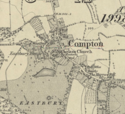
Ordnance Survey 6 inch - 1 mile, 1871.
The National Library of Scotland has a fine selection of English Ordnance Survey maps on their website, including the first edition of 1871.
Explore the website to find other maps of just about everywhere in these islands!
|